 |
| 1. Suggest an appropriate order for each data layer from top to bottom? An apprpoiate order for the layers that would make more sense would be putting Earharst's cities first (top), Flight route second, Countries third, and the Graticule last (bottom). 2. Name all US cities along Earhart's path: Oakland, Tucson, New Orleans, & Miami 3. Name other countries Earhart flies over: Karachi, Bangkok, Signapore, Darwin, & Natal |
Wednesday, September 7, 2011
GIS Lab 2 -Ex. 3a

Tuesday, September 6, 2011
GIS Lab 1 - Own Map
View Driving routes to Perquin, El Salvador in a larger map http://g.co/maps/38wyw Location Morazan, El Salvador C.A. for reasons of putting this map, it was unfinished from the original map. The map was missing a few routes and places where people/tourist can go, visit, and be aware of while going to the North Eastern outbacks of El Salvador. So then I modified it with a few details for people/tourist can convey and make use of this map to get to the town of Perquin to visit the Revolutionary Museum and Recreation Site.
Wednesday, August 31, 2011
Geog Lab 1 Map-3
 |
| http://www.google.com/imgres?q=park+map&hl=en&gbv=2&addh=36&tbm=isch&tbnid=qygFCZ80FQwlGM:&imgrefurl=http://www.meetup.com/Chicago-Digital-Photo/files/&docid=ZSF6YyqwwMb0NM&w=583&h=454&ei=YopeToT-LuLkiALsz7SzBQ&zoom=1&iact=rc&page=2&tbnh=140&tbnw=198&start=27&ndsp=29&ved=1t:429,r:24,s:27&tx=80&ty=54&biw=1920&bih=1079 I chose this map because it looks more like drawn animated. The map depicts itself as a recreational park center. Also the data that presents has polygons, rather than just lines and dots. Not the mention that there is only lines (roads) and the dots are named places like that fountain, plaza, or garden. There is a slight difference from the other two maps, this map has like a 2-dimensional structure. |
Geog Lab 1 Map-2
 |
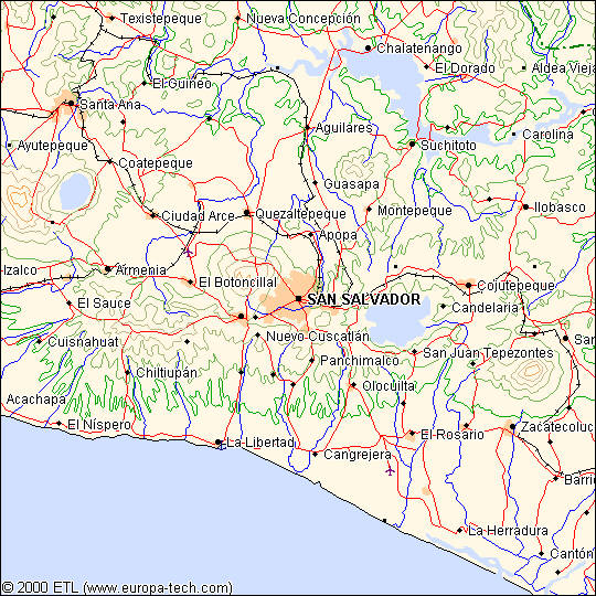
| http://salvaspan.homestead.com/files/la_libertad.jpg Even though its kind of a fast map and small, it looks plain. The Mid-West of El Salvador C.A. mostly urbanize and highly populated cities shown in peach color. Notice that the color is known for what it is, obvious blue for rivers, green for plains while they rise to high altitude terrain, red for major transits, and black for railroad tracks. Upon the data mostly lines and dots, but not much polygon depiction. |
Geog Lab 1 Map-1
 |
| http://www.virgin-islands-on-line.com/st/st-thomas-map.shtml The St. Thomas (US) island map depicts routes, banking services, tourist centers, and snapshot moments. For the routes, notice that they have a distinct different color, its because the touring aspect of each route that is has different attraction to experience from it. The map shows how gas stations and especially banks/atm are at every 1/2 mile or 1 mile for tourist. Other than dots and lines for data, there were no river lines for this island map. |
Subscribe to:
Posts (Atom)